The Phoenix Valley Metro Light Rail began operation in 2008, further extended its service in 2015, 2016, 2019, and 2022. The total length of the centerline of the routes is approximately 28 miles with 38 stations. A one-mile radius buffer around each station covers approximately 44 square miles. This system would service most major commuting areas in the Las Vegas metro.
Phoenix Light Rail
Phoenix Light Rail mapped to the Las Vegas Valley
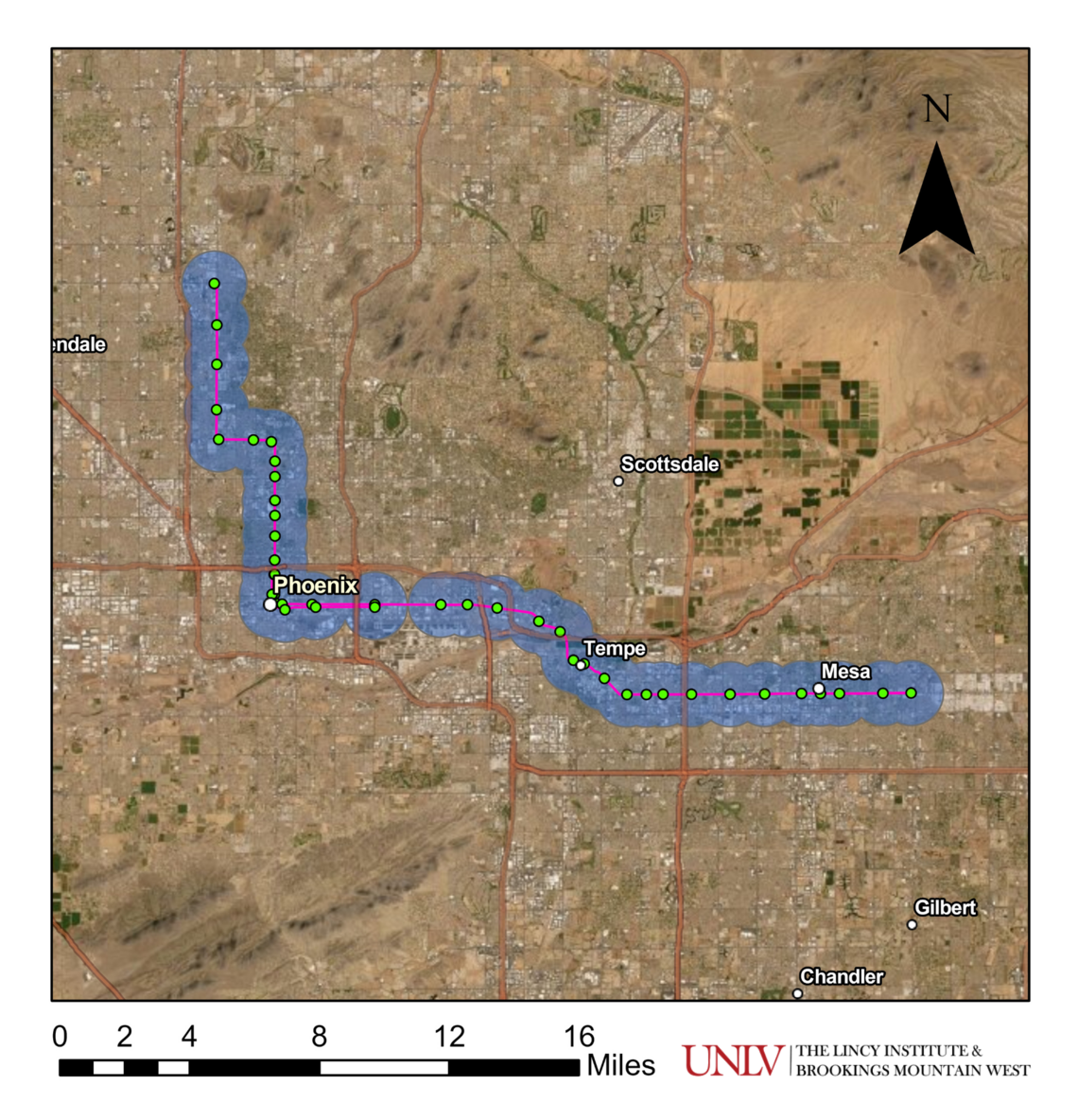
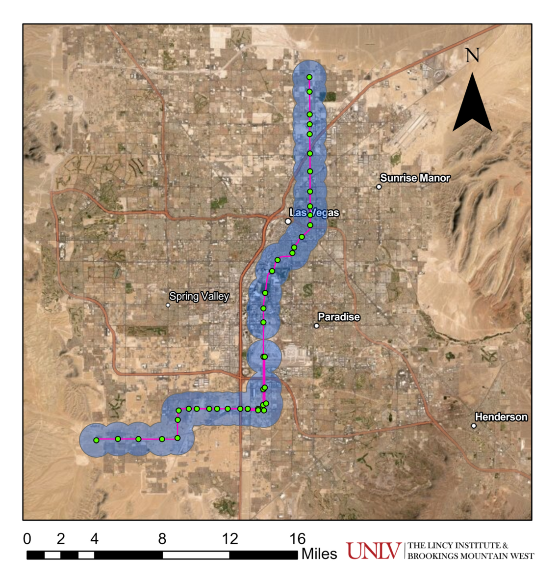
These data visualizations are created from publicly available information derived from Valley Metro Open Data System Map.
Data Source: Valley Metro Open Data System Map. Year: 2022. Retrieved in October 2022. Visualization by Dr. Jaewon Lim and Joshua Padilla. © The Data Hub at The Lincy Institute and Brookings Mountain West, UNLV.